We are selling source code for this app please contact us at maps@techmaven.net 754-333-1650
Ready for any data
Easily view online Geospatial Data ESRI and OGC Mapping Services, File Based Formats, Draw and Edit Vector Data
GPS & IP Geolocation
Show your position, Show Coordinates Google Place Search and GeoCoding
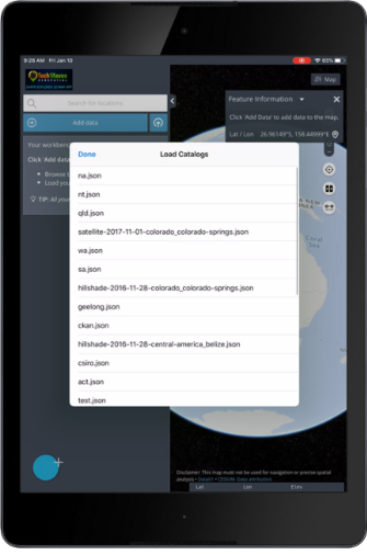
Catalog for Managing Data
Earth Explorer 3D Map App includes a Catalog Management Application that allows you to configure online mapping services for use in the app and also share those with friends and co-workers in a friendly JSON format.
Jam Packed with Useful Features
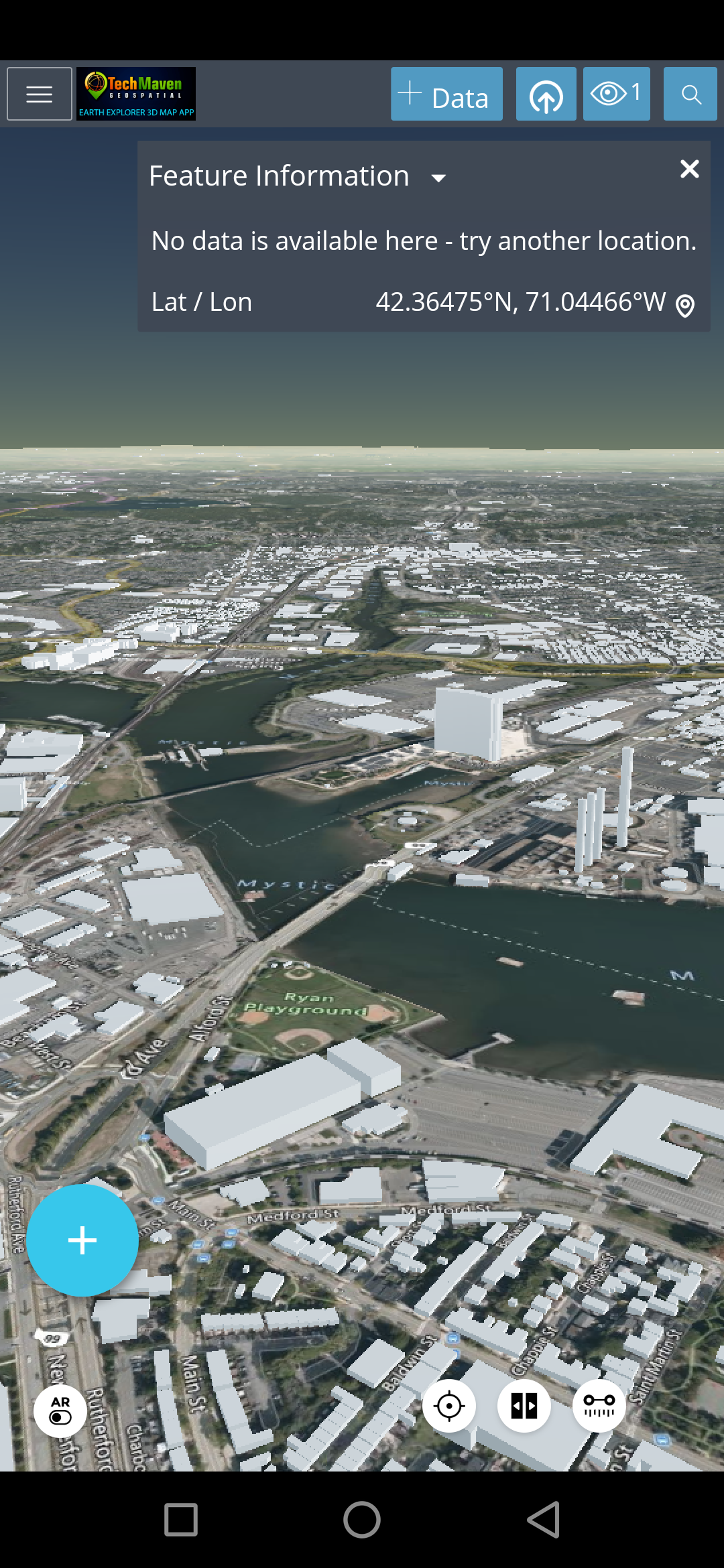
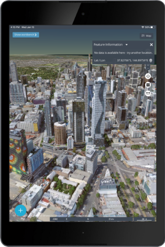
Easy to use ! Easy to consume/view/discover data and perform visualization. Easily query data and get a feature info popup and lat long coordinates


Earth Explorer 3D Map App is the perfect app for your desktop and tablet and mobile phone
Feature Tour
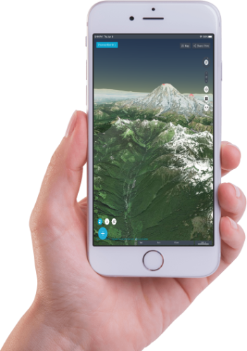
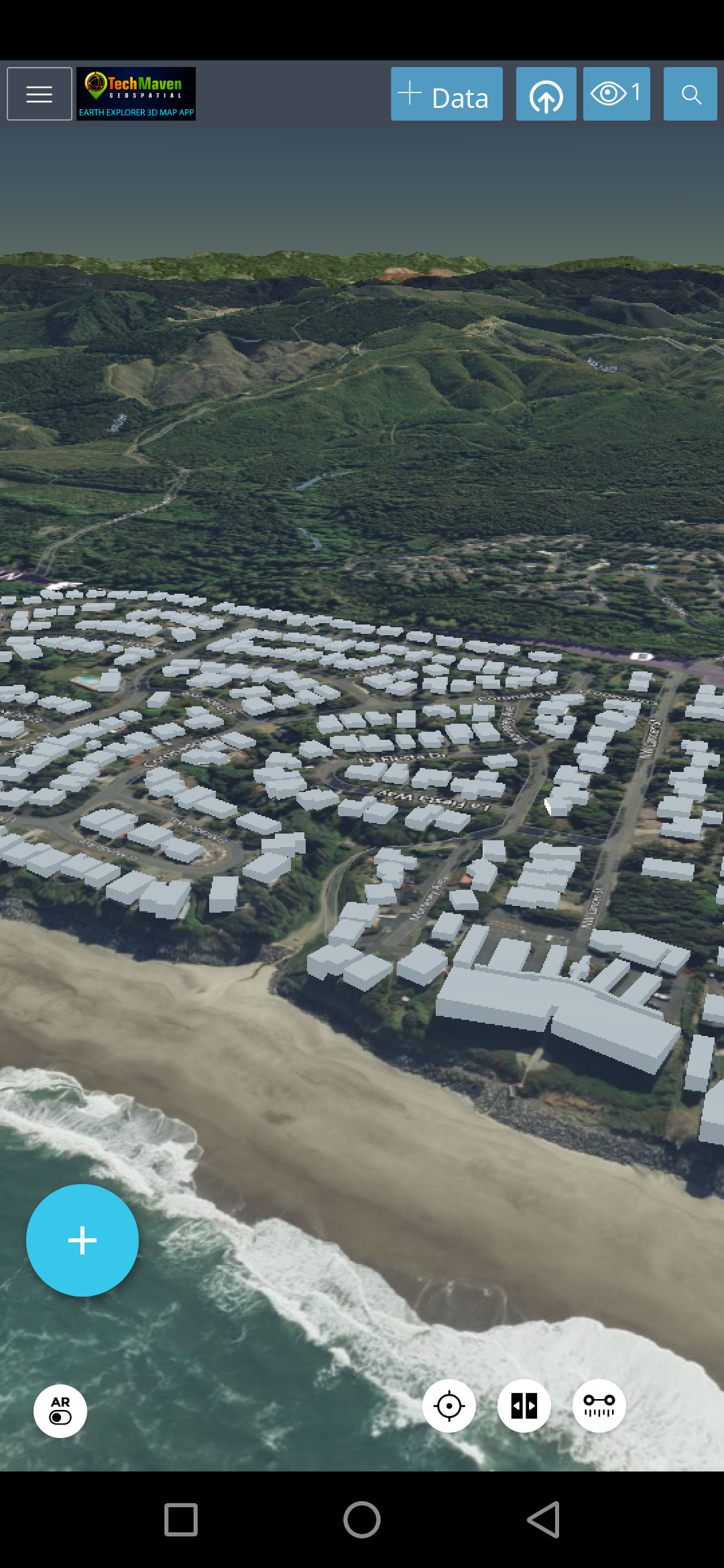
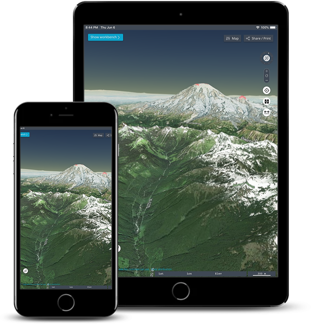
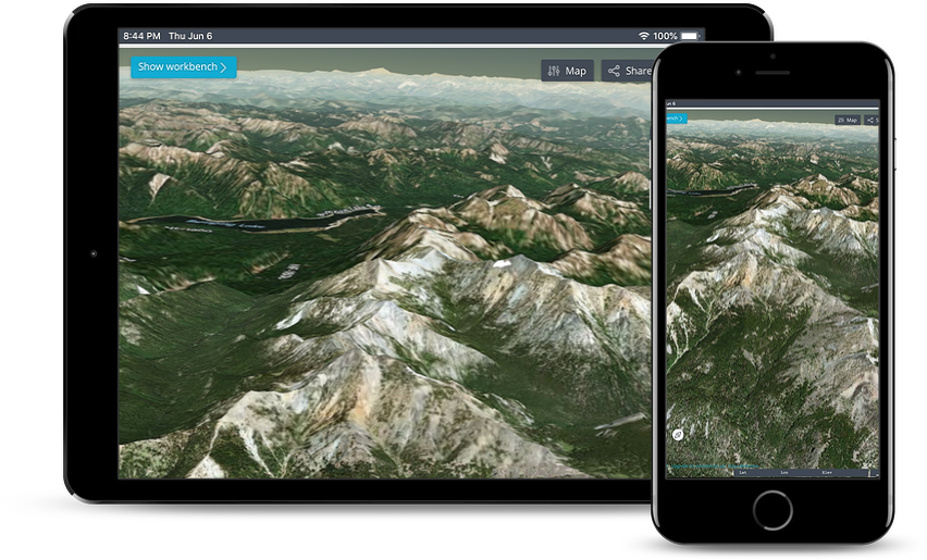
3D Terrain View/Scenes
Load data from catalog
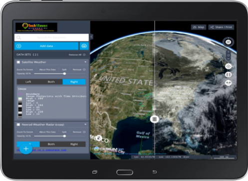
Swipe layers feature
Geonames Mapservices
Augmented Reality
Coordinates
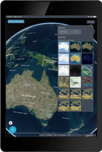
Other Basemaps Geolocation
Download i3S SceneServer
Load Vector Tiles
Earth Explorer 3D Map App supports 3D Tiles
these can be hosted online on a Static File Server or loaded onto the app for offline use
make a zip file and rename it 3DTiles and load it into the app (iTunes filesharing )
3D Tiles can visualize 3D Buildings and Features, 3D Point Cloud Data (LiDAR), 3D Terrain surface, 3D Model of physical structures,etc.
You will soon be able to convert your 3D Data into 3D Tiles with our online conversion service http://geodataconverter.online
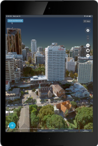
Earth Explorer Videos with Google Photorealistic 3D Buildings
100’s of Features
We designed Earth Explorer 3D Map app as a fun experiment initially being able to plan our outdoor adventures and travels. Visualize terrain data and quickly access mapping services to mashup local and internet data. Augmented Reality feature is fun and innovative.
Map Viewing
Augmented Reality
Attribute Grid with Search
View GeoPackage Vector Features Attributes and Search
Future versions will offer support for CSV, GeoJSON, KML, GPX and Shapefile Tables
Create and Edit GeoJSON
Create and Edit (digitize) GeoJSON
Geolocation
Switch map
Raster Tile Basemap Picker
Measure Linear and Area
Vector Tiles
View PBF Vector Tiles is now fully supported in 1.1
Placemarks
Create Spatial Bookmarks/Waypoints of your favorite locations
3D Terrain Visualization
Build Highly Immersive Scenes (3D)
PNTS 3DTILES LiDAR Point Cloud Viewing
OSM 3D Buildings
Search Loaded Data
Search Catalogs and Search Loaded Data
View Metadata
Load a Catalog, Clear a Catalog, Share a Map Via the Power URL’s
Charting
Charting
View location in Bing Maps Streetside and Oblique and View Bing Maps Satellite and Street Map on the map
Bing
Displays Coordinates
in latitude longitude,UTM, MGRS and GARS
Go to Coordinates (move the map) in multiple formats
Support for high precision external Bluetooth GPS / GNSS Receivers
Works Landscape or Portrait Mode
Re-order data layers
Timeslider
Change Screen Orientation
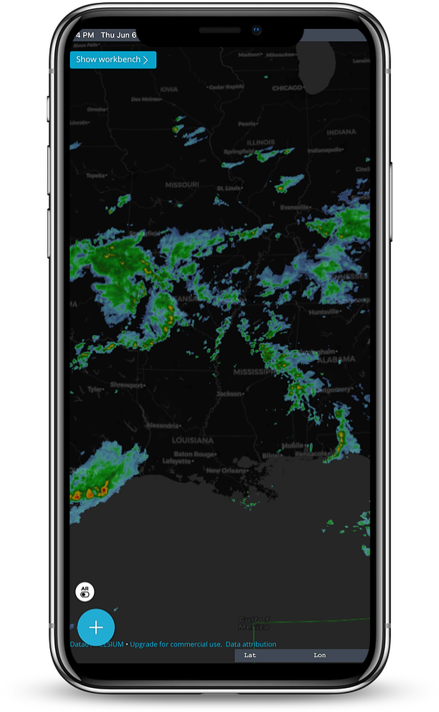
View Spatial Temporal Data
Playback Time Dimensional Spatial Data like CZML and KML


Convert GIS Vector Data
Convert ESRI FileGeoDatabases, OGC GeoPackage SQLite databases, ESRI Shapefiles and other formats into GeoJSON for consumption in Earth Explorer 3D Map App
Supported Formats:
| Files | Services |
|---|---|
| GeoJSON & TopoJSON | OGC WMTS Raster TILES |
| KMZ/KML | OGC WMS |
| CZML | ESRI ArcGIS Map Services |
| GPX | ESRI ArcGIS Feature Services |
| TEXT -TSV, CSV | ESRI ArcGIS Image Services |
| ESRI Shapefile | Raster Tile Server (XYZ/TMS) |
| ESRI FileGDB via in App Conversion | OGC WFS - Web Feature Service |
| OGC GeoPackage vector features | Raster Tiles XYZ and TMS |
| SOS Sensors IOT | |
Earth Explorer 3D Map App is the perfect app for your desktop and tablet and mobile phone
Ready to get started?
Download the app from your app store or contact us for custom builds and versions. For Windows, we have Windows MSI and EXE builds in addition to the Windows Store APPX
We would love to hear from you
Mobile GIS Viewer/Editor/Analysis
If your looking for GIS Editing/Data Creation and Analysis please check out our feature-rich 2D Mapping Apps
Check out GeoData Explorer
and Map Discovery
Earth Explorer 3D Map proudly developed by Tech Maven Geospatial. https://techmaven.net
We would love to hear your feedback and ideas for future scope